| Item Detail |
| |
| |
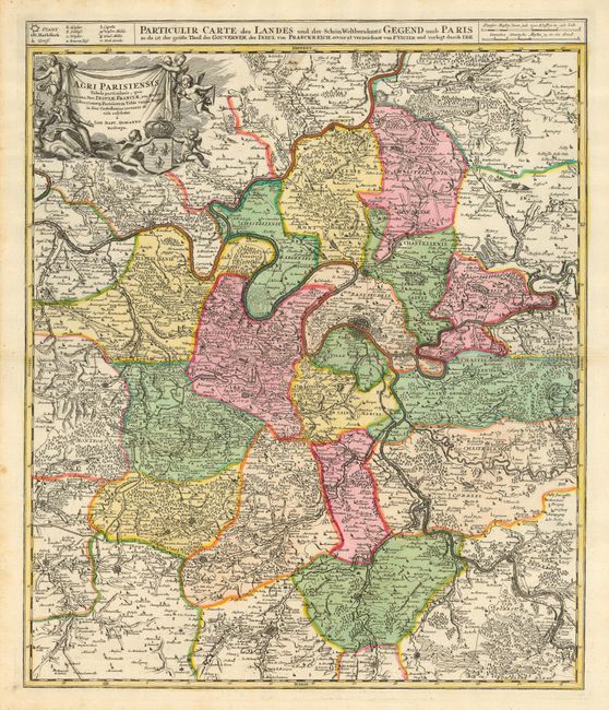
MapMaker: |
Johann Baptist Homann
|
|
| |
| |
Subject: |
France |
|
| |
Period/Size: |
1716 / 22.4" x 18.8" (56.9 x 47.8 cm)
|
|
| |
Color: |
Colored
|
|
| |
Condition: |
(A) Very early and fine impression, original bright hand coloring. Cartouche uncolored as issued. Small, light area of surface soiling at top, a little marginal foxing, else fine. (condition help) |
|
| |
Source: |
Grosser Atlas |
|
| |
References: |
|
|
| |
|
|
| Sales Information |
| |
| |
Price: |
|
|
| |
| |
Offered by: |
Old World Auctions |
|
| |
Catalog: |
Auction No. 118 - Antique Maps, Charts, Atlases & Globes (584) |
|
| |
Lot/Item #: |
634 |
|
| |
| |
Date: |
03/2007
|
|
| |
| |
|