| Item Detail |
| |
| |
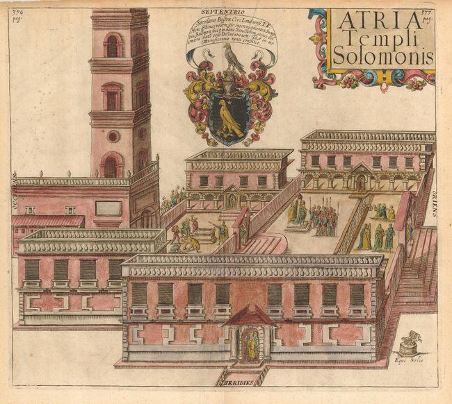
MapMaker: |
Thomas Fuller
|
|
| |
| |
Subject: |
Holy Land, Jerusalem |
|
| |
Period/Size: |
1650 / 11.5" x 13.0" (29.3 x 33.1 cm)
|
|
| |
Color: |
Colored
|
|
| |
Condition: |
(B) An attractive plan with a nice impression. The delicate, later color shows through on the verso. The sheet is lightly toned with some short tears and chips in the margins. One small tear is repaired on the verso with archival tape. (condition help) |
|
| |
Source: |
A Pisgah Sight of Palestine |
|
| |
References: |
Laor, p. 178. |
|
| |
|
|
| Sales Information |
| |
| |
Price: |
|
|
| |
| |
Offered by: |
Old World Auctions |
|
| |
Catalog: |
Auction No. 119 - Antique Maps, Charts, Atlases & Globes (585) |
|
| |
Lot/Item #: |
755 |
|
| |
| |
Date: |
05/2007
|
|
| |
| |
|