| Item Detail |
| |
| |
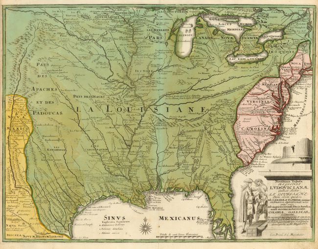
MapMaker: |
Christopher Weigel
|
|
| |
| |
Subject: |
Colonial United States |
|
| |
Period/Size: |
1734 / 12.3" x 16.0" (31.3 x 40.7 cm)
|
|
| |
Color: |
Colored
|
|
| |
Condition: |
(B) Old color with slightly uneven toning. Side margins are trimmed, with some paper reinforcing them on the verso, but they are still adequate for framing. (condition help) |
|
| |
Source: |
|
|
| |
References: |
Fite & Freeman #46; Tooley (Amer) p. 21. |
|
| |
|
|
| Sales Information |
| |
| |
Price: |
|
|
| |
| |
Offered by: |
Old World Auctions |
|
| |
Catalog: |
Auction No. 119 - Antique Maps, Charts, Atlases & Globes (585) |
|
| |
Lot/Item #: |
162 |
|
| |
| |
Date: |
05/2007
|
|
| |
| |
|