Title:
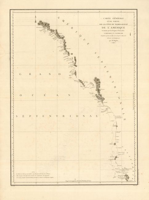
“Carte Generale d'une Partie de la Cote du Nord-Ouest de l'Amerique reconnue par les Fregates Francaises La Boussole et l'Astrolabe…”
Map Maker:
Jean Francois Galaup de La Perouse
Superb large-scale map of the West Coast from Mont... (full text available to subscribers)
| Item Detail |
| |
| |
MapMaker: |
Jean Francois Galaup de La Perouse
|
|
| |
| |
Subject: |
Western Canada & United States |
|
| |
Period/Size: |
1797 / 27.0" x 19.3" (68.6 x 49.1 cm)
|
|
| |
Color: |
Black & White
|
|
| |
Condition: |
(B) Nice impression on a strong, clean sheet of hand-laid paper. The map has some light offsetting and a light foxing. (condition help) |
|
| |
Source: |
|
|
| |
References: |
Falk #1797-8; Wagner (NW) #840. |
|
| |
|
|
| Sales Information |
| |
| |
Price: |
|
|
| |
| |
Offered by: |
Old World Auctions |
|
| |
Catalog: |
Auction No. 119 - Antique Maps, Charts, Atlases & Globes (585) |
|
| |
Lot/Item #: |
147 |
|
| |
| |
Date: |
05/2007
|
|
| |
| |
|
Antique Maps - Valuation and Pricing, Descriptions, Resources |
|
Home |
Information |
Search |
Register |
Contact Us |
Site Map
Americana Exchange, Inc. © 1999 - 2024 Americana Exchange, Inc.. All rights reserved.
OldMaps.com, the OldMaps.com logo and
AMPR are service marks or registered service marks of Americana Exchange, Inc..
|