Title:
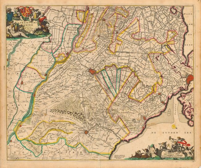
“Ultraiectini Dominii Tabula”
Map Maker:
Frederick de Wit
This large, bold map is centered on Utrecht, and s... (full text available to subscribers)
| Item Detail |
| |
| |
MapMaker: |
Frederick de Wit
|
|
| |
| |
Subject: |
Netherlands |
|
| |
Period/Size: |
1690 / 18.0" x 22.0" (45.8 x 55.9 cm)
|
|
| |
Color: |
Colored
|
|
| |
Condition: |
(B) Truly lovely, original color and a sharp impression. Scattered spots and staining throughout. Archival tissue reinforcing two spots on the centerfold. (condition help) |
|
| |
Source: |
|
|
| |
References: |
|
|
| |
|
|
| Sales Information |
| |
| |
Price: |
|
|
| |
| |
Offered by: |
Old World Auctions |
|
| |
Catalog: |
Auction No. 118 - Antique Maps, Charts, Atlases & Globes (584) |
|
| |
Lot/Item #: |
592 |
|
| |
| |
Date: |
03/2007
|
|
| |
| |
|
Antique Maps - Valuation and Pricing, Descriptions, Resources |
|
Home |
Information |
Search |
Register |
Contact Us |
Site Map
Americana Exchange, Inc. © 1999 - 2024 Americana Exchange, Inc.. All rights reserved.
OldMaps.com, the OldMaps.com logo and
AMPR are service marks or registered service marks of Americana Exchange, Inc..
|