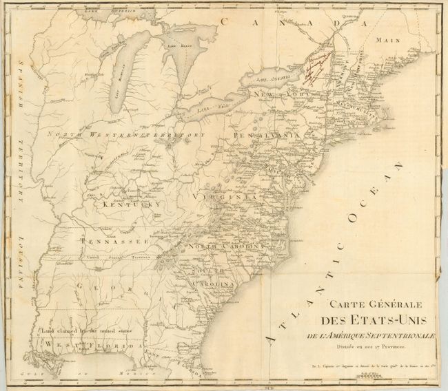
Title:
“Carte Generale des Etats-Unis de l'Amerique Septentrionale Divisee en ses 17 Provinces”
Map Maker:
Francois Alexander de La Rochefoucald-Liancourt
This is a French edition of the general map of Roc... (full text available to subscribers)
| Item Detail |
| |
| |
MapMaker: |
Francois Alexander de La Rochefoucald-Liancourt
|
|
| |
| |
Subject: |
United States - Eastern |
|
| |
Period/Size: |
1800 / 15.5" x 18.5" (39.4 x 47.0 cm)
|
|
| |
Color: |
Black & White
|
|
| |
Condition: |
(B) A few spots, otherwise a very good example with sharp impression printed on fine hand laid paper with large watermark. Issued folded with close margins and binding trim. (condition help) |
|
| |
Source: |
Voyage dans les Etats-Unisģ (Travels through the United States) |
|
| |
References: |
cf Phillips (M) p. 873.2 |
|
| |
|
|
| Sales Information |
| |
| |
Price: |
|
|
| |
| |
Offered by: |
Old World Auctions |
|
| |
Catalog: |
Auction No. 118 - Antique Maps, Charts, Atlases & Globes (584) |
|
| |
Lot/Item #: |
227 |
|
| |
| |
Date: |
03/2007
|
|
| |
| |
|
Antique Maps - Valuation and Pricing, Descriptions, Resources |
|
Home |
Information |
Search |
Register |
Contact Us |
Site Map
Americana Exchange, Inc. © 1999 - 2024 Americana Exchange, Inc.. All rights reserved.
OldMaps.com, the OldMaps.com logo and
AMPR are service marks or registered service marks of Americana Exchange, Inc..
|