Title:
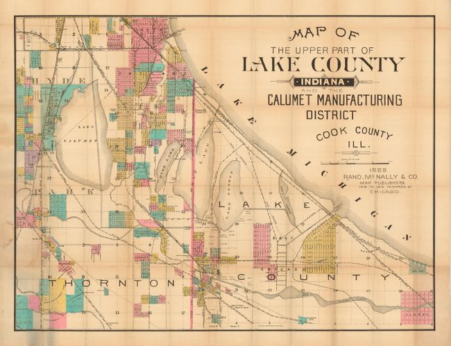
“Map of the Upper Part of Lake County, Indiana, and the Calumet Manufacturing District, Cook County, Ill.”
Map Maker:
Rand, McNally & Co.
A very large and colorful map of southeastern Chic... (full text available to subscribers)
| Item Detail |
| |
| |
MapMaker: |
Rand, McNally & Co.
|
|
| |
| |
Subject: |
Chicago, Illinois and Indiana |
|
| |
Period/Size: |
1888 / 25.3" x 33.0" (64.3 x 83.9 cm)
|
|
| |
Color: |
Colored
|
|
| |
Condition: |
(B) Map with some minor toning and the usual tiny intersection splits, and a light stain where the paper is adhered to the back cover. Covers are lightly soiled, otherwise fine. (condition help) |
|
| |
Source: |
|
|
| |
References: |
|
|
| |
|
|
| Sales Information |
| |
| |
Price: |
|
|
| |
| |
Offered by: |
Old World Auctions |
|
| |
Catalog: |
Auction No. 119 - Antique Maps, Charts, Atlases & Globes (585) |
|
| |
Lot/Item #: |
273 |
|
| |
| |
Date: |
05/2007
|
|
| |
| |
|
Antique Maps - Valuation and Pricing, Descriptions, Resources |
|
Home |
Information |
Search |
Register |
Contact Us |
Site Map
Americana Exchange, Inc. © 1999 - 2024 Americana Exchange, Inc.. All rights reserved.
OldMaps.com, the OldMaps.com logo and
AMPR are service marks or registered service marks of Americana Exchange, Inc..
|