Rister or Sign In to see pricing information


Title:

Historical Map of Nantucket. Surveyed and Drawn by The Rev. E. C. Ewer D.D.

Map Maker:

Railroad Companies

Historical Map of Nantucket.  Surveyed and Drawn by The Rev. E. C. Ewer D.D.

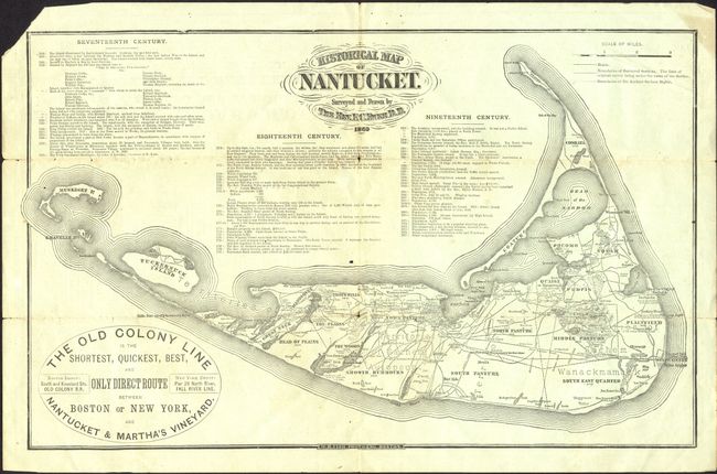
This ephemeral pocket map advertises "The Old Colo... (full text available to subscribers)
Item Detail
 
  MapMaker:  

Railroad Companies


  Subject:  Massachusetts, Nantucket  
  Period/Size:  1879 / 8.5" x 13.5"  (21.6 x 34.3 cm)  
  Color:  Black & White  
  Condition:  (B) Loss of upper left corner, just outside neatline. Light toning on folds with a small fold intersection split. (condition help)  
  Source:   
  References:   
 
 
Sales Information
 
  Price: 

Please register your email to view records, or sign in with email address to see records


  Offered by:  Old World Auctions  
  Catalog:  Auction No. 119 - Antique Maps, Charts, Atlases & Globes (585)  
  Lot/Item #:  296  
 
  Date:  05/2007  


Antique Maps - Valuation and Pricing, Descriptions, Resources


Home | Information | Search | Register | Contact Us | Site Map

Americana Exchange, Inc. © 1999 - 2024 Americana Exchange, Inc.. All rights reserved. OldMaps.com, the OldMaps.com logo and
AMPR are service marks or registered service marks of Americana Exchange, Inc..