Title:
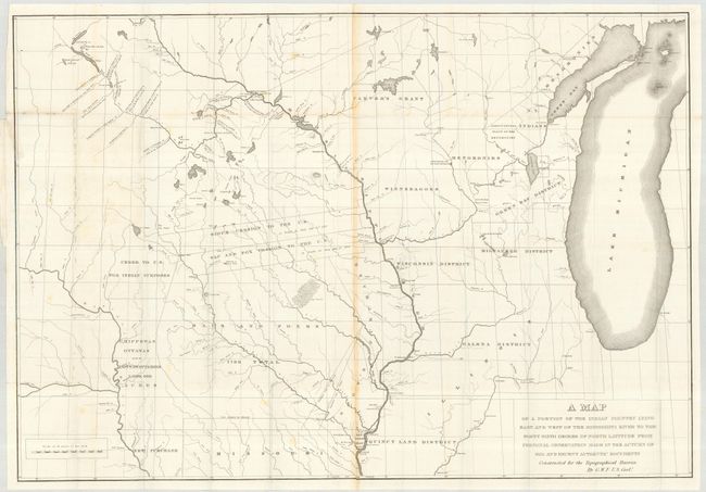
“A Map of a Portion of the Indian Country Lying East and West of the Mississippi River to the Forty Sixth Degree of North Latitude from Personal Observation Made in the Autumn of 1835 and Recent Authentic Documents …”
Map Maker:
U.S. Government
Interesting and expansive map centered primarily o... (full text available to subscribers)
| Item Detail |
| |
| |
MapMaker: |
U.S. Government
|
|
| |
| |
Subject: |
United States - Central |
|
| |
Period/Size: |
1836 / 26.2" x 37.9" (66.6 x 96.3 cm)
|
|
| |
Color: |
Black & White
|
|
| |
Condition: |
(B) Sharp impression with some toning on paper joint. Left portion of map has some small areas of loss along the fold. Left binding edge with some tears just into the map closed with archival tape on the verso. Still good for a map of this type. (condition help) |
|
| |
Source: |
Report of a geological reconnaissance…to the Coteau de Prairie |
|
| |
References: |
Claussen & Friis #94. |
|
| |
|
|
| Sales Information |
| |
| |
Price: |
|
|
| |
| |
Offered by: |
Old World Auctions |
|
| |
Catalog: |
Auction No. 119 - Antique Maps, Charts, Atlases & Globes (585) |
|
| |
Lot/Item #: |
206 |
|
| |
| |
Date: |
05/2007
|
|
| |
| |
|
Antique Maps - Valuation and Pricing, Descriptions, Resources |
|
Home |
Information |
Search |
Register |
Contact Us |
Site Map
Americana Exchange, Inc. © 1999 - 2024 Americana Exchange, Inc.. All rights reserved.
OldMaps.com, the OldMaps.com logo and
AMPR are service marks or registered service marks of Americana Exchange, Inc..
|