| Item Detail |
| |
| |
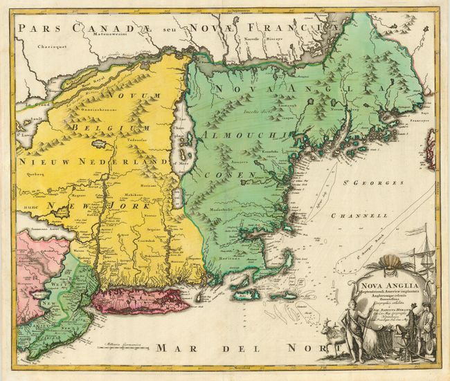
MapMaker: |
Johann Baptist Homann
|
|
| |
| |
Subject: |
Colonial New England |
|
| |
Period/Size: |
1720 / 19.2" x 23.0" (48.8 x 58.5 cm)
|
|
| |
Color: |
Colored
|
|
| |
Condition: |
(B) Sharp impression printed on sturdy paper with strong original color. There are a couple of light, unobtrusive spots in the cartouche, else very good. (condition help) |
|
| |
Source: |
|
|
| |
References: |
McCorkle #724.1; Portinaro & Knirsch #116; Sellers and Van Ee #806. |
|
| |
|
|
| Sales Information |
| |
| |
Price: |
|
|
| |
| |
Offered by: |
Old World Auctions |
|
| |
Catalog: |
Auction No. 119 - Antique Maps, Charts, Atlases & Globes (585) |
|
| |
Lot/Item #: |
174 |
|
| |
| |
Date: |
05/2007
|
|
| |
| |
|