Title:
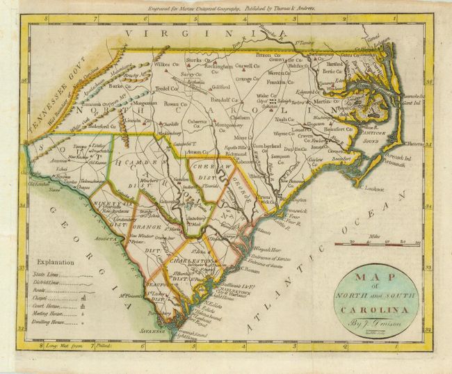
“Map of North and South Carolina By J. Denison”
Map Maker:
Jedidiah Morse
This interesting little map of the Carolinas shows... (full text available to subscribers)
| Item Detail |
| |
| |
MapMaker: |
Jedidiah Morse
|
|
| |
| |
Subject: |
United States - Southeast |
|
| |
Period/Size: |
1796 / 7.5" x 9.3" (19.1 x 23.7 cm)
|
|
| |
Color: |
Colored
|
|
| |
Condition: |
(B) There is a small area of paper weakness that has been reinforced on verso with light Japanese tissue and it has been remargined on binding side (left). (condition help) |
|
| |
Source: |
American Universel Geography |
|
| |
References: |
Wheat & Brun #585. |
|
| |
|
|
| Sales Information |
| |
| |
Price: |
|
|
| |
| |
Offered by: |
Old World Auctions |
|
| |
Catalog: |
Auction No. 119 - Antique Maps, Charts, Atlases & Globes (585) |
|
| |
Lot/Item #: |
196 |
|
| |
| |
Date: |
05/2007
|
|
| |
| |
|
Antique Maps - Valuation and Pricing, Descriptions, Resources |
|
Home |
Information |
Search |
Register |
Contact Us |
Site Map
Americana Exchange, Inc. © 1999 - 2024 Americana Exchange, Inc.. All rights reserved.
OldMaps.com, the OldMaps.com logo and
AMPR are service marks or registered service marks of Americana Exchange, Inc..
|