| Item Detail |
| |
| |
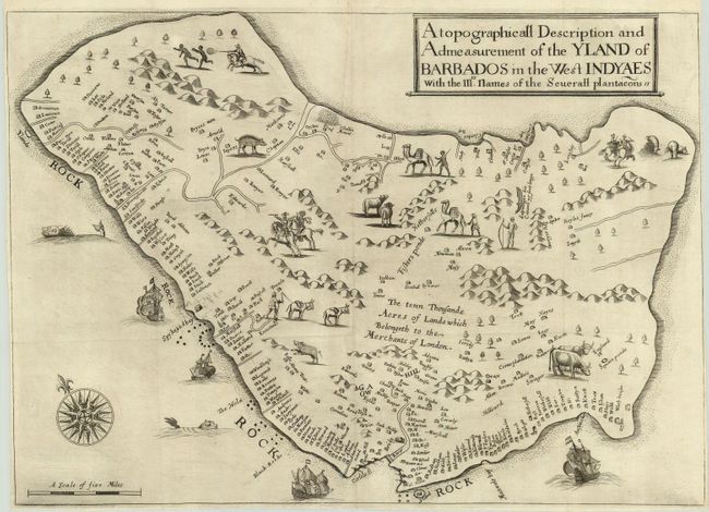
MapMaker: |
Richard Ligon
|
|
| |
| |
Subject: |
Barbados |
|
| |
Period/Size: |
1657 / 14.5" x 20.3" (36.9 x 51.6 cm)
|
|
| |
Color: |
Black & White
|
|
| |
Condition: |
(A+) Fine impression printed on hand-laid paper with narrow margins, as issued. Issued folding, now pressed and ready for framing. (condition help) |
|
| |
Source: |
A true & exact history of the island of Barbados |
|
| |
References: |
Campbell (MCC-21) p. 9, #1. |
|
| |
|
|
| Sales Information |
| |
| |
Price: |
|
|
| |
| |
Offered by: |
Old World Auctions |
|
| |
Catalog: |
Auction No. 119 - Antique Maps, Charts, Atlases & Globes (585) |
|
| |
Lot/Item #: |
416 |
|
| |
| |
Date: |
05/2007
|
|
| |
| |
|