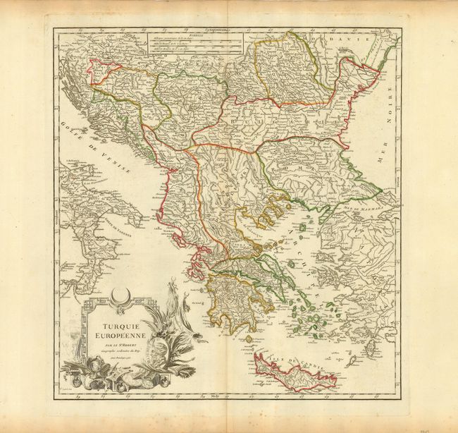
Title:
“Turquie Europeenne”
Map Maker:
Gilles Robert de Vaugondy
Handsome map of the Ottoman possessions in Greece ... (full text available to subscribers)
| Item Detail |
| |
| |
MapMaker: |
Gilles Robert de Vaugondy
|
|
| |
| |
Subject: |
Balkans |
|
| |
Period/Size: |
1755 / 18.8" x 17.6" (47.8 x 44.7 cm)
|
|
| |
Color: |
Colored
|
|
| |
Condition: |
(A) Sharp impression and original outline color. The margins are very wide with a little scattered foxing not affecting map. (condition help) |
|
| |
Source: |
|
|
| |
References: |
Pedley #367. |
|
| |
|
|
| Sales Information |
| |
| |
Price: |
|
|
| |
| |
Offered by: |
Old World Auctions |
|
| |
Catalog: |
Auction No. 119 - Antique Maps, Charts, Atlases & Globes (585) |
|
| |
Lot/Item #: |
684 |
|
| |
| |
Date: |
05/2007
|
|
| |
| |
|
Antique Maps - Valuation and Pricing, Descriptions, Resources |
|
Home |
Information |
Search |
Register |
Contact Us |
Site Map
Americana Exchange, Inc. © 1999 - 2024 Americana Exchange, Inc.. All rights reserved.
OldMaps.com, the OldMaps.com logo and
AMPR are service marks or registered service marks of Americana Exchange, Inc..
|