Title:
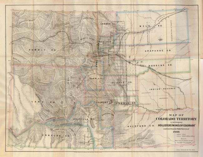
“Map of Colorado Territory to accompany Hollister's 'Mines of Colorado' corrected from the Public Surveys of 1866”
Map Maker:
Ovando James Hollister
This scarce map of Colorado shows great detail thr... (full text available to subscribers)
| Item Detail |
| |
| |
MapMaker: |
Ovando James Hollister
|
|
| |
| |
Subject: |
Colorado |
|
| |
Period/Size: |
1867 / 16.0" x 21.0" (40.7 x 53.4 cm)
|
|
| |
Color: |
Colored
|
|
| |
Condition: |
(A) The folding map is near fine less a 3" tear from the binding trim that just touches the edge of Weld County. The book cover is a little rubbed with some chipping on spine. The contents are near fine less the first few pages with a tiny stain at uppe (condition help) |
|
| |
Source: |
The Mines of Colorado |
|
| |
References: |
|
|
| |
|
|
| Sales Information |
| |
| |
Price: |
|
|
| |
| |
Offered by: |
Old World Auctions |
|
| |
Catalog: |
Auction No. 119 - Antique Maps, Charts, Atlases & Globes (585) |
|
| |
Lot/Item #: |
250 |
|
| |
| |
Date: |
05/2007
|
|
| |
| |
|
Antique Maps - Valuation and Pricing, Descriptions, Resources |
|
Home |
Information |
Search |
Register |
Contact Us |
Site Map
Americana Exchange, Inc. © 1999 - 2024 Americana Exchange, Inc.. All rights reserved.
OldMaps.com, the OldMaps.com logo and
AMPR are service marks or registered service marks of Americana Exchange, Inc..
|