| Item Detail |
| |
| |
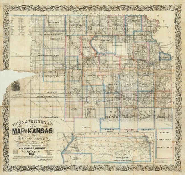
MapMaker: |
Gunn & Mitchell
|
|
| |
| |
Subject: |
Kansas & Colorado |
|
| |
Period/Size: |
1862 / 25.5" x 27.5" (64.8 x 69.9 cm)
|
|
| |
Color: |
Colored
|
|
| |
Condition: |
(C) Printed on thin banknote paper. Original hand coloring and nice impression. Issued folding, now backed on thin Japanese tissue. A couple of small holes with little loss in inset map. The main map has a portion of paper missing at left center, just (condition help) |
|
| |
Source: |
|
|
| |
References: |
Rumsey #3632; cf Wheat (TMW) 976 and Streeter 2017; Wagner-Camp #327:2. |
|
| |
|
|
| Sales Information |
| |
| |
Price: |
|
|
| |
| |
Offered by: |
Old World Auctions |
|
| |
Catalog: |
Auction No. 119 - Antique Maps, Charts, Atlases & Globes (585) |
|
| |
Lot/Item #: |
278 |
|
| |
| |
Date: |
05/2007
|
|
| |
| |
|