Title:
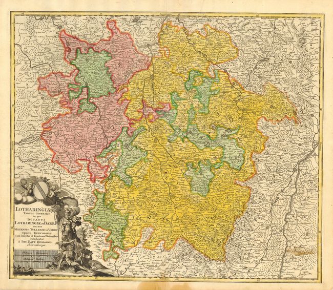
“Lotharingiae Tabula Generalis in qua Ducatus Lotharingiae et Barri nec non Metensis, Tullensis et Verdunensis Episcopatus”
Map Maker:
Johann Baptist Homann
A large copper plate map of the Lorraine region th... (full text available to subscribers)
| Item Detail |
| |
| |
MapMaker: |
Johann Baptist Homann
|
|
| |
| |
Subject: |
France |
|
| |
Period/Size: |
1716 / 19.0" x 22.5" (48.3 x 57.2 cm)
|
|
| |
Color: |
Colored
|
|
| |
Condition: |
(B) Crisp impression and fine original coloring on hand laid paper with original margins. One light stain at lower right of map and another in lower margin just into border. (condition help) |
|
| |
Source: |
Grosser Atlas |
|
| |
References: |
|
|
| |
|
|
| Sales Information |
| |
| |
Price: |
|
|
| |
| |
Offered by: |
Old World Auctions |
|
| |
Catalog: |
Auction No. 121 - Antique Maps, Charts, Atlases & Globes (614) |
|
| |
Lot/Item #: |
539 |
|
| |
| |
Date: |
09/2007
|
|
| |
| |
|
Antique Maps - Valuation and Pricing, Descriptions, Resources |
|
Home |
Information |
Search |
Register |
Contact Us |
Site Map
Americana Exchange, Inc. © 1999 - 2024 Americana Exchange, Inc.. All rights reserved.
OldMaps.com, the OldMaps.com logo and
AMPR are service marks or registered service marks of Americana Exchange, Inc..
|