Title:
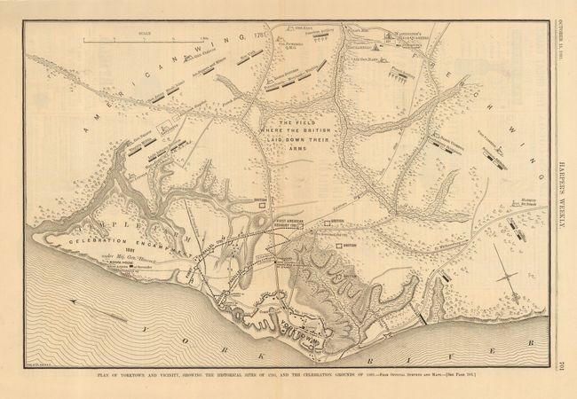
“Plan of Yorktown and Vicinity, showing the Historical Sites of 1781, and the Celebration Grounds of 1881”
Map Maker:
Harper & Brothers
Interesting map of Yorktown created on the 100th a... (full text available to subscribers)
| Item Detail |
| |
| |
MapMaker: |
Harper & Brothers
|
|
| |
| |
Subject: |
Virginia |
|
| |
Period/Size: |
1881 / 9.2" x 14.0" (23.4 x 35.6 cm)
|
|
| |
Color: |
Black & White
|
|
| |
Condition: |
(A) A few soft creases. (condition help) |
|
| |
Source: |
Harper's Weekly |
|
| |
References: |
|
|
| |
|
|
| Sales Information |
| |
| |
Price: |
|
|
| |
| |
Offered by: |
Old World Auctions |
|
| |
Catalog: |
Auction No. 122 - Antique Maps, Charts, Atlases & Globes (615) |
|
| |
Lot/Item #: |
344 |
|
| |
| |
Date: |
12/2007
|
|
| |
| |
|
Antique Maps - Valuation and Pricing, Descriptions, Resources |
|
Home |
Information |
Search |
Register |
Contact Us |
Site Map
Americana Exchange, Inc. © 1999 - 2024 Americana Exchange, Inc.. All rights reserved.
OldMaps.com, the OldMaps.com logo and
AMPR are service marks or registered service marks of Americana Exchange, Inc..
|