| Item Detail |
| |
| |
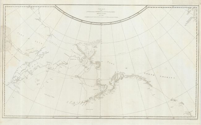
MapMaker: |
James Cook
|
|
| |
| |
Subject: |
North Pacific Ocean and Western North America |
|
| |
Period/Size: |
1784 / 15.3" x 26.3" (38.9 x 66.8 cm)
|
|
| |
Color: |
Black & White
|
|
| |
Condition: |
(B) The map is generally clean, but has some edge tears, with two entering the map on the left and one in the top margin, not affecting the map The tears have been repaired with archival tissue on the recto. (condition help) |
|
| |
Source: |
Voyage to the Pacific Ocean… |
|
| |
References: |
Kershaw #1140; Verner & Stubbs #40, pp. 194. |
|
| |
|
|
| Sales Information |
| |
| |
Price: |
|
|
| |
| |
Offered by: |
Old World Auctions |
|
| |
Catalog: |
Auction No. 120 - Antique Maps, Charts, Atlases & Globes (613) |
|
| |
Lot/Item #: |
793 |
|
| |
| |
Date: |
07/2007
|
|
| |
| |
|