Title:
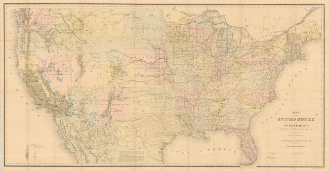
“Map of the United States and Territories. Showing the extent of Public Surveys and other details…”
Map Maker:
General Land Office
This map, in full original hand color, is one of t... (full text available to subscribers)
| Item Detail |
| |
| |
MapMaker: |
General Land Office
|
|
| |
| |
Subject: |
United States |
|
| |
Period/Size: |
1867 / 28.0" x 54.8" (71.2 x 139.2 cm)
|
|
| |
Color: |
Colored
|
|
| |
Condition: |
(A) Map is clean and bright with full margins, a near fine example. One short split into map, closed on verso and a couple small intersection fold splits. Most fold intersections with archival tape on verso for support. Report has a little water spotti (condition help) |
|
| |
Source: |
Report of the Commissioner of General Land Office for the Year 1867 |
|
| |
References: |
|
|
| |
|
|
| Sales Information |
| |
| |
Price: |
|
|
| |
| |
Offered by: |
Old World Auctions |
|
| |
Catalog: |
Auction No. 120 - Antique Maps, Charts, Atlases & Globes (613) |
|
| |
Lot/Item #: |
167 |
|
| |
| |
Date: |
07/2007
|
|
| |
| |
|
Antique Maps - Valuation and Pricing, Descriptions, Resources |
|
Home |
Information |
Search |
Register |
Contact Us |
Site Map
Americana Exchange, Inc. © 1999 - 2024 Americana Exchange, Inc.. All rights reserved.
OldMaps.com, the OldMaps.com logo and
AMPR are service marks or registered service marks of Americana Exchange, Inc..
|