Title:
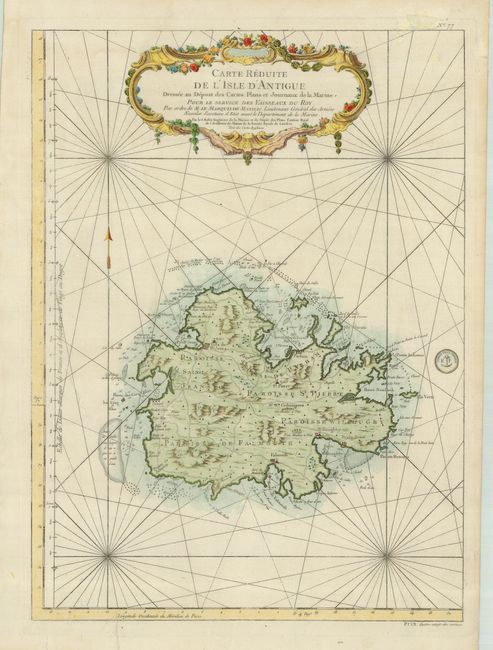
“Carte Reduite de l'Isle d'Antigue Dressee au Depost des Cartes, Plans et Jounaux de la Marine…”
Map Maker:
Jacques Nicolas Bellin
Fine, large-scale map of Antigua provides detailed... (full text available to subscribers)
| Item Detail |
| |
| |
MapMaker: |
Jacques Nicolas Bellin
|
|
| |
| |
Subject: |
Antigua |
|
| |
Period/Size: |
1758 / 22.3" x 16.3" (56.7 x 41.4 cm)
|
|
| |
Color: |
Colored
|
|
| |
Condition: |
(B) Strong impression printed on sturdy paper. There are some repaired tears in the margins and one in the blank part of the map off the western shoreline. (condition help) |
|
| |
Source: |
Hydrographie Francoise |
|
| |
References: |
|
|
| |
|
|
| Sales Information |
| |
| |
Price: |
|
|
| |
| |
Offered by: |
Old World Auctions |
|
| |
Catalog: |
Auction No. 120 - Antique Maps, Charts, Atlases & Globes (613) |
|
| |
Lot/Item #: |
413 |
|
| |
| |
Date: |
07/2007
|
|
| |
| |
|
Antique Maps - Valuation and Pricing, Descriptions, Resources |
|
Home |
Information |
Search |
Register |
Contact Us |
Site Map
Americana Exchange, Inc. © 1999 - 2024 Americana Exchange, Inc.. All rights reserved.
OldMaps.com, the OldMaps.com logo and
AMPR are service marks or registered service marks of Americana Exchange, Inc..
|