Title:
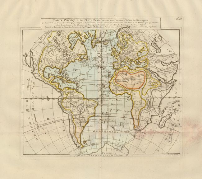
“Carte Physique de l'Ocean ou l'on Voit des Grandes Chaines de Montagnes qui traversent les Continents d'Europe, d'Afrique et d'Amerique…”
Map Maker:
Philip Buache
This unusual map was issued in a series by Philipp... (full text available to subscribers)
| Item Detail |
| |
| |
MapMaker: |
Philip Buache
|
|
| |
| |
Subject: |
Atlantic Ocean |
|
| |
Period/Size: |
1757 / 11.8" x 13.8" (30.0 x 35.1 cm)
|
|
| |
Color: |
Colored
|
|
| |
Condition: |
(B) Nice impression and coloring with very wide margins. Folding as issued with damp stain or mildew along horizontal fold. (condition help) |
|
| |
Source: |
|
|
| |
References: |
|
|
| |
|
|
| Sales Information |
| |
| |
Price: |
|
|
| |
| |
Offered by: |
Old World Auctions |
|
| |
Catalog: |
Auction No. 121 - Antique Maps, Charts, Atlases & Globes (614) |
|
| |
Lot/Item #: |
411 |
|
| |
| |
Date: |
09/2007
|
|
| |
| |
|
Antique Maps - Valuation and Pricing, Descriptions, Resources |
|
Home |
Information |
Search |
Register |
Contact Us |
Site Map
Americana Exchange, Inc. © 1999 - 2024 Americana Exchange, Inc.. All rights reserved.
OldMaps.com, the OldMaps.com logo and
AMPR are service marks or registered service marks of Americana Exchange, Inc..
|