Title:
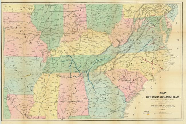
“Map of United States Military Rail Roads, Showing the Rail Roads Operated during the War from 1862-1866, as Military Lines under the Direction of Bvt. Brig. Gen. B.C. McCallum, Director and General Manager”
Map Maker:
U.S. War Department
Interesting map produced the year following the cl... (full text available to subscribers)
| Item Detail |
| |
| |
MapMaker: |
U.S. War Department
|
|
| |
| |
Subject: |
Mid-Atlantic |
|
| |
Period/Size: |
1866 / 25.0" x 38.0" (63.5 x 96.6 cm)
|
|
| |
Color: |
Colored
|
|
| |
Condition: |
(+B) A bright example with fine original coloring and full margins. Folding, as issued. A couple of fold intersection splits, closed on verso and a small crescent puncture that is not visible from front, also closed on verso. (condition help) |
|
| |
Source: |
|
|
| |
References: |
|
|
| |
|
|
| Sales Information |
| |
| |
Price: |
|
|
| |
| |
Offered by: |
Old World Auctions |
|
| |
Catalog: |
Auction No. 120 - Antique Maps, Charts, Atlases & Globes (613) |
|
| |
Lot/Item #: |
204 |
|
| |
| |
Date: |
07/2007
|
|
| |
| |
|
Antique Maps - Valuation and Pricing, Descriptions, Resources |
|
Home |
Information |
Search |
Register |
Contact Us |
Site Map
Americana Exchange, Inc. © 1999 - 2024 Americana Exchange, Inc.. All rights reserved.
OldMaps.com, the OldMaps.com logo and
AMPR are service marks or registered service marks of Americana Exchange, Inc..
|