Title:
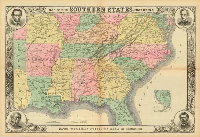
“Map of the Southern States, Including Railroads, County Towns, State Capitals, County Roads, the Southern Coast from Delaware to Texas, Showing the Harbors, Inlets, Forts and Position of Blockading Ships…”
Map Maker:
Harper & Brothers
This terrific Civil War map shows good deta... (full text available to subscribers)
| Item Detail |
| |
| |
MapMaker: |
Harper & Brothers
|
|
| |
| |
Subject: |
Southern United States - |
|
| |
Period/Size: |
1863 / 20.0" x 30.0" (50.8 x 76.2 cm)
|
|
| |
Color: |
Colored
|
|
| |
Condition: |
(+C) Folding, as issued. This example has terrific original coloring, full margins and a dark impression. One fold has some toning with two splits, a few other intersection fold splits, and some marginal tears or chipping, all closed on verso with archi (condition help) |
|
| |
Source: |
Harper's History of the Great Rebellion |
|
| |
References: |
cf Stephenson #37. |
|
| |
|
|
| Sales Information |
| |
| |
Price: |
|
|
| |
| |
Offered by: |
Old World Auctions |
|
| |
Catalog: |
Auction No. 120 - Antique Maps, Charts, Atlases & Globes (613) |
|
| |
Lot/Item #: |
214 |
|
| |
| |
Date: |
07/2007
|
|
| |
| |
|
Antique Maps - Valuation and Pricing, Descriptions, Resources |
|
Home |
Information |
Search |
Register |
Contact Us |
Site Map
Americana Exchange, Inc. © 1999 - 2024 Americana Exchange, Inc.. All rights reserved.
OldMaps.com, the OldMaps.com logo and
AMPR are service marks or registered service marks of Americana Exchange, Inc..
|