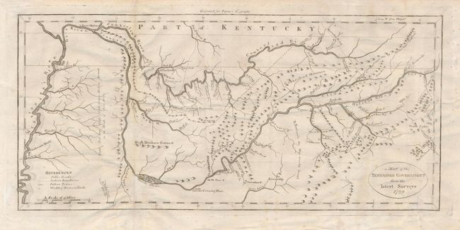
Title:
“A Map of the Tennassee Government from the Latest Surveys”
Map Maker:
John Willet Payne
This is a very early depiction of Tennessee based... (full text available to subscribers)
| Item Detail |
| |
| |
MapMaker: |
John Willet Payne
|
|
| |
| |
Subject: |
Tennessee |
|
| |
Period/Size: |
1799 / 7.0" x 15.0" (17.8 x 38.1 cm)
|
|
| |
Color: |
Black & White
|
|
| |
Condition: |
(B) A few light creases and scattered light foxing. The folds have all been reinforced with tissue on the verso. (condition help) |
|
| |
Source: |
John Payne's New and Complete Universal Geography |
|
| |
References: |
Wheat & Brun #657. |
|
| |
|
|
| Sales Information |
| |
| |
Price: |
|
|
| |
| |
Offered by: |
Old World Auctions |
|
| |
Catalog: |
Auction No. 120 - Antique Maps, Charts, Atlases & Globes (613) |
|
| |
Lot/Item #: |
295 |
|
| |
| |
Date: |
07/2007
|
|
| |
| |
|
Antique Maps - Valuation and Pricing, Descriptions, Resources |
|
Home |
Information |
Search |
Register |
Contact Us |
Site Map
Americana Exchange, Inc. © 1999 - 2024 Americana Exchange, Inc.. All rights reserved.
OldMaps.com, the OldMaps.com logo and
AMPR are service marks or registered service marks of Americana Exchange, Inc..
|