| Item Detail |
| |
| |
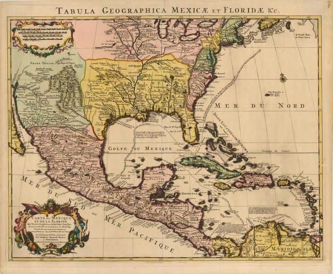
MapMaker: |
Delisle/Covens & Mortier
|
|
| |
| |
Subject: |
Colonial North America and Caribbean |
|
| |
Period/Size: |
1722 / 19.0" x 23.5" (48.3 x 59.7 cm)
|
|
| |
Color: |
Colored
|
|
| |
Condition: |
(A) Lovely, velvety impression and original color. The map has some tiny marginal tears, and the lower margin has been extended, even though the original margin is generous. Professional repair of a small separation in the top centerfold, not entering t (condition help) |
|
| |
Source: |
|
|
| |
References: |
Tooley [Amer] #51; Schwartz & Ehrenberg Plt. 82; cf Cummings (SE) #137; Martin & Martin plt.17. |
|
| |
|
|
| Sales Information |
| |
| |
Price: |
|
|
| |
| |
Offered by: |
Old World Auctions |
|
| |
Catalog: |
Auction No. 120 - Antique Maps, Charts, Atlases & Globes (613) |
|
| |
Lot/Item #: |
116 |
|
| |
| |
Date: |
07/2007
|
|
| |
| |
|