| Item Detail |
| |
| |
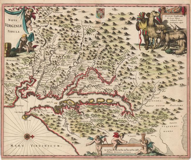
MapMaker: |
Montanus/Ogilby
|
|
| |
| |
Subject: |
Colonial Chesapeake Bay |
|
| |
Period/Size: |
1671 / 11.5" x 14.0" (29.3 x 35.6 cm)
|
|
| |
Color: |
Colored
|
|
| |
Condition: |
(B) Narrow margins, as issued, with slight loss of neatline at bottom left. Old paper tape repairs on verso, including one behind a small hole about 2" under the cartouche. One short tear at right just into the border has been repaired with archival tap (condition help) |
|
| |
Source: |
America… |
|
| |
References: |
Burden (II) #412; Tooley (Amer) p.168-9, plt. 76; Goss (NA) #38. |
|
| |
|
|
| Sales Information |
| |
| |
Price: |
|
|
| |
| |
Offered by: |
Old World Auctions |
|
| |
Catalog: |
Auction No. 120 - Antique Maps, Charts, Atlases & Globes (613) |
|
| |
Lot/Item #: |
198 |
|
| |
| |
Date: |
07/2007
|
|
| |
| |
|