Title:
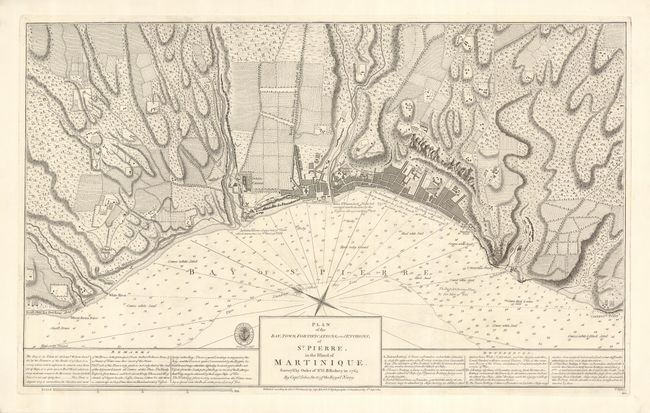
“Plan of the Bay, Town, Fortifications, and Environs, of St. Pierre, in the Island of Martinique. Survey'd by Order of Sr. G.B. Rodney in 1763 by Captn. John Stott of the Royal Navy”
Map Maker:
British Admiralty
A rare, copper engraved plan with incredible detai... (full text available to subscribers)
| Item Detail |
| |
| |
MapMaker: |
British Admiralty
|
|
| |
| |
Subject: |
Martinique |
|
| |
Period/Size: |
1814 / 15.5" x 25.3" (39.4 x 64.3 cm)
|
|
| |
Color: |
Black & White
|
|
| |
Condition: |
(A) Minor soiling to the corners well away from the image. Nice, wide margins, and a very crisp impression on bright paper. (condition help) |
|
| |
Source: |
|
|
| |
References: |
|
|
| |
|
|
| Sales Information |
| |
| |
Price: |
|
|
| |
| |
Offered by: |
Old World Auctions |
|
| |
Catalog: |
Auction No. 120 - Antique Maps, Charts, Atlases & Globes (613) |
|
| |
Lot/Item #: |
407 |
|
| |
| |
Date: |
07/2007
|
|
| |
| |
|
Antique Maps - Valuation and Pricing, Descriptions, Resources |
|
Home |
Information |
Search |
Register |
Contact Us |
Site Map
Americana Exchange, Inc. © 1999 - 2024 Americana Exchange, Inc.. All rights reserved.
OldMaps.com, the OldMaps.com logo and
AMPR are service marks or registered service marks of Americana Exchange, Inc..
|