| Item Detail |
| |
| |
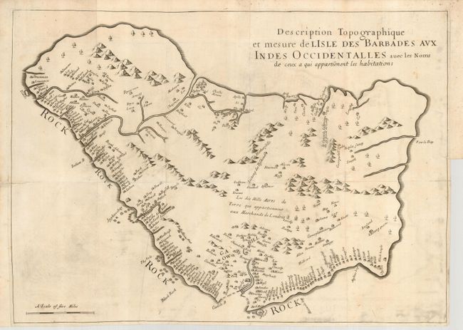
MapMaker: |
Richard Ligon
|
|
| |
| |
Subject: |
Barbados |
|
| |
Period/Size: |
1674 / 15.0" x 20.0" (38.1 x 50.8 cm)
|
|
| |
Color: |
Black & White
|
|
| |
Condition: |
(B) A nice dark impression on a sheet with folds as issued. Close right binding side, with two short repaired tears just into the map. There are a few minor stains, light offsetting and some printer's ink residue. (condition help) |
|
| |
Source: |
Histoire de l'Isle des Barbades |
|
| |
References: |
|
|
| |
|
|
| Sales Information |
| |
| |
Price: |
|
|
| |
| |
Offered by: |
Old World Auctions |
|
| |
Catalog: |
Auction No. 122 - Antique Maps, Charts, Atlases & Globes (615) |
|
| |
Lot/Item #: |
392 |
|
| |
| |
Date: |
12/2007
|
|
| |
| |
|