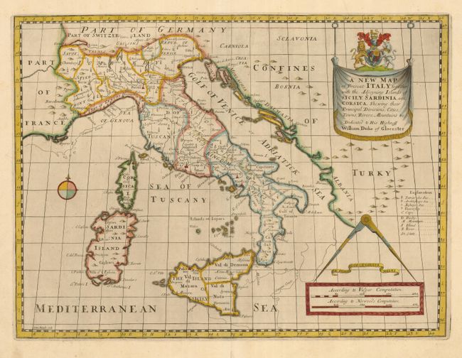
Title:
“A New Map of Present Italy, together with the Adjoyning Islands of Sicily, Sardinia, and Corsica, Shewing Their Principal Divisions…”
Map Maker:
Edward Wells
Crisply engraved map of the various states and rep... (full text available to subscribers)
| Item Detail |
| |
| |
MapMaker: |
Edward Wells
|
|
| |
| |
Subject: |
Italy |
|
| |
Period/Size: |
1700 / 14.5" x 19.4" (36.9 x 49.3 cm)
|
|
| |
Color: |
Colored
|
|
| |
Condition: |
(A) Lovely impression and color with wide margins. Professional repair on fold separation in bottom margin (condition help) |
|
| |
Source: |
A New Sett of Maps |
|
| |
References: |
|
|
| |
|
|
| Sales Information |
| |
| |
Price: |
|
|
| |
| |
Offered by: |
Old World Auctions |
|
| |
Catalog: |
Auction No. 120 - Antique Maps, Charts, Atlases & Globes (613) |
|
| |
Lot/Item #: |
655 |
|
| |
| |
Date: |
07/2007
|
|
| |
| |
|
Antique Maps - Valuation and Pricing, Descriptions, Resources |
|
Home |
Information |
Search |
Register |
Contact Us |
Site Map
Americana Exchange, Inc. © 1999 - 2024 Americana Exchange, Inc.. All rights reserved.
OldMaps.com, the OldMaps.com logo and
AMPR are service marks or registered service marks of Americana Exchange, Inc..
|