Title:
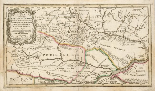
“Die Gegend Zwischen Pultava und Bender Mitt Angraenzenden Polnisch, Turckisch und Tartarischen Landschafften”
Map Maker:
Bodenehr [Family]
A handsome little map of the central portion of th... (full text available to subscribers)
| Item Detail |
| |
| |
MapMaker: |
Bodenehr [Family]
|
|
| |
| |
Subject: |
Ukraine |
|
| |
Period/Size: |
1720 / 6.8" x 11.8" (17.2 x 29.9 cm)
|
|
| |
Color: |
Colored
|
|
| |
Condition: |
(B) Some staining and soil at the edges of the map. Light toning on centerfold. (condition help) |
|
| |
Source: |
|
|
| |
References: |
|
|
| |
|
|
| Sales Information |
| |
| |
Price: |
|
|
| |
| |
Offered by: |
Old World Auctions |
|
| |
Catalog: |
Auction No. 120 - Antique Maps, Charts, Atlases & Globes (613) |
|
| |
Lot/Item #: |
624 |
|
| |
| |
Date: |
07/2007
|
|
| |
| |
|
Antique Maps - Valuation and Pricing, Descriptions, Resources |
|
Home |
Information |
Search |
Register |
Contact Us |
Site Map
Americana Exchange, Inc. © 1999 - 2024 Americana Exchange, Inc.. All rights reserved.
OldMaps.com, the OldMaps.com logo and
AMPR are service marks or registered service marks of Americana Exchange, Inc..
|