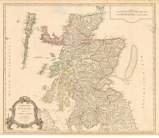
Title:
“Le Royaume d'Ecosse divisee en Shires ou Comtes”
Map Maker:
Gilles Robert de Vaugondy
This is the second state of this handsome map of S... (full text available to subscribers)
| Item Detail |
| |
| |
MapMaker: |
Gilles Robert de Vaugondy
|
|
| |
| |
Subject: |
Scotland |
|
| |
Period/Size: |
1751 / 19.3" x 22.5" (48.9 x 57.2 cm)
|
|
| |
Color: |
Colored
|
|
| |
Condition: |
(B) Dark impression on sound paper with original outline color. Printer's crease and smudges at top. (condition help) |
|
| |
Source: |
Atlas Universel |
|
| |
References: |
Pedley #52. |
|
| |
|
|
| Sales Information |
| |
| |
Price: |
|
|
| |
| |
Offered by: |
Old World Auctions |
|
| |
Catalog: |
Auction No. 120 - Antique Maps, Charts, Atlases & Globes (613) |
|
| |
Lot/Item #: |
478 |
|
| |
| |
Date: |
07/2007
|
|
| |
| |
|
Antique Maps - Valuation and Pricing, Descriptions, Resources |
|
Home |
Information |
Search |
Register |
Contact Us |
Site Map
Americana Exchange, Inc. © 1999 - 2024 Americana Exchange, Inc.. All rights reserved.
OldMaps.com, the OldMaps.com logo and
AMPR are service marks or registered service marks of Americana Exchange, Inc..
|