Title:
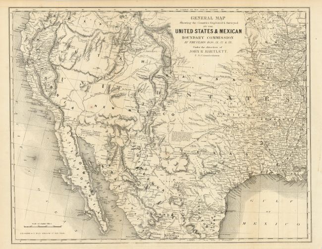
“General Map Showing the Countries Explored & Surveyed by the United States & Mexico Boundary Commission in the Years 1850, 51, 52 & 53 Under the Direction of John R. Bartlett”
Map Maker:
John Russell Bartlett
This map covers the entire West from the Mississip... (full text available to subscribers)
| Item Detail |
| |
| |
MapMaker: |
John Russell Bartlett
|
|
| |
| |
Subject: |
United States & Mexico |
|
| |
Period/Size: |
1855 / 15.0" x 19.3" (38.1 x 49.1 cm)
|
|
| |
Color: |
Black & White
|
|
| |
Condition: |
(B) On spot in New Mexico and a binding trim tear that just enters map, closed on verso with archival tape. (condition help) |
|
| |
Source: |
Personal Narrative of Explorationsģ |
|
| |
References: |
Wheat (TMW) #798; Wagner-Camp #234:1 |
|
| |
|
|
| Sales Information |
| |
| |
Price: |
|
|
| |
| |
Offered by: |
Old World Auctions |
|
| |
Catalog: |
Auction No. 120 - Antique Maps, Charts, Atlases & Globes (613) |
|
| |
Lot/Item #: |
359 |
|
| |
| |
Date: |
07/2007
|
|
| |
| |
|
Antique Maps - Valuation and Pricing, Descriptions, Resources |
|
Home |
Information |
Search |
Register |
Contact Us |
Site Map
Americana Exchange, Inc. © 1999 - 2024 Americana Exchange, Inc.. All rights reserved.
OldMaps.com, the OldMaps.com logo and
AMPR are service marks or registered service marks of Americana Exchange, Inc..
|