| Item Detail |
| |
| |
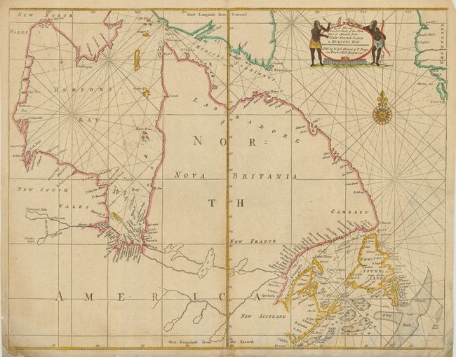
MapMaker: |
Mount & Page
|
|
| |
| |
Subject: |
Eastern Canada |
|
| |
Period/Size: |
1753 / 17.0" x 21.8" (43.2 x 55.4 cm)
|
|
| |
Color: |
Colored
|
|
| |
Condition: |
(B) Dark impression. The sheet has a split in the bottom centerfold about 1.5" into map. Bottom corners with some repairs and soil. One small wormhole in the lower, blank portion of map. (condition help) |
|
| |
Source: |
The English Pilot, The Fourth Book |
|
| |
References: |
Verner and Stuart-Stubbs #31; Kershaw #223. |
|
| |
|
|
| Sales Information |
| |
| |
Price: |
|
|
| |
| |
Offered by: |
Old World Auctions |
|
| |
Catalog: |
Auction No. 120 - Antique Maps, Charts, Atlases & Globes (613) |
|
| |
Lot/Item #: |
124 |
|
| |
| |
Date: |
07/2007
|
|
| |
| |
|