Rister or Sign In to see pricing information


Title:

Plan de la Ville et du Port de Louisbourg Leve en 1756…

Map Maker:

Depot de la Marine

Plan de la Ville et du Port de Louisbourg Leve en 1756…

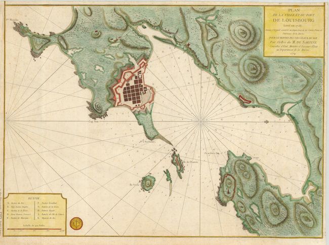
Lovely chart of the fortified town and coast of Lo... (full text available to subscribers)
Item Detail
 
  MapMaker:  

Depot de la Marine


  Subject:  Canada, Louisbourg, Cape Breton  
  Period/Size:  1779 / 16.6" x 23.0"  (42.2 x 58.5 cm)  
  Color:  Colored  
  Condition:  (B) On a sturdy sheet with trimmed margins, still sufficient for framing. A bit of very light foxing. (condition help)  
  Source:   
  References:  Sellers & Van Ee #341; Kershaw #938.  
 
 
Sales Information
 
  Price: 

Please register your email to view records, or sign in with email address to see records


  Offered by:  Old World Auctions  
  Catalog:  Auction No. 120 - Antique Maps, Charts, Atlases & Globes (613)  
  Lot/Item #:  131  
 
  Date:  07/2007  


Antique Maps - Valuation and Pricing, Descriptions, Resources


Home | Information | Search | Register | Contact Us | Site Map

Americana Exchange, Inc. © 1999 - 2024 Americana Exchange, Inc.. All rights reserved. OldMaps.com, the OldMaps.com logo and
AMPR are service marks or registered service marks of Americana Exchange, Inc..