Title:
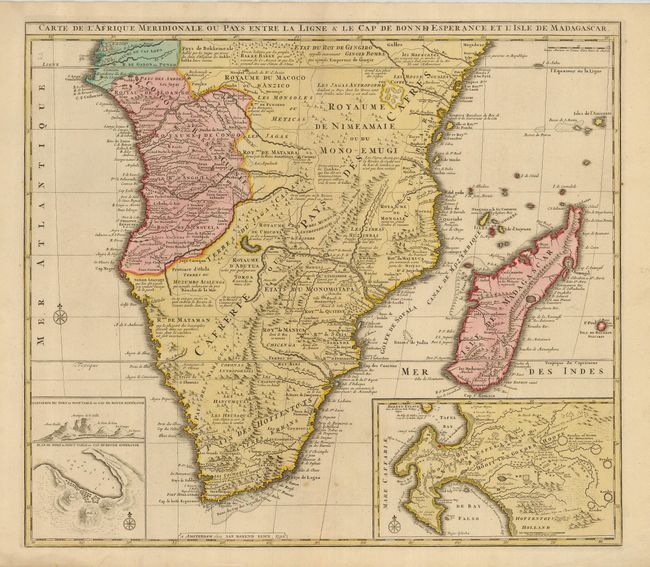
“Carte de l'Afrique Meridionale ou Pays entre la Ligne & le Cap de Bonne Esperance, et l'Isle de Madagascar”
Map Maker:
Jan Barend Elwe
A fine folio map of Africa south of the Equator in... (full text available to subscribers)
| Item Detail |
| |
| |
MapMaker: |
Jan Barend Elwe
|
|
| |
| |
Subject: |
Southern Africa |
|
| |
Period/Size: |
1792 / 19.8" x 23.8" (50.3 x 60.5 cm)
|
|
| |
Color: |
Colored
|
|
| |
Condition: |
(A) A nice impression on a sound sheet with good original margins and color. The map has a couple faint spots of foxing that do no detract from the map. (condition help) |
|
| |
Source: |
|
|
| |
References: |
Norwich #180. |
|
| |
|
|
| Sales Information |
| |
| |
Price: |
|
|
| |
| |
Offered by: |
Old World Auctions |
|
| |
Catalog: |
Auction No. 120 - Antique Maps, Charts, Atlases & Globes (613) |
|
| |
Lot/Item #: |
784 |
|
| |
| |
Date: |
07/2007
|
|
| |
| |
|
Antique Maps - Valuation and Pricing, Descriptions, Resources |
|
Home |
Information |
Search |
Register |
Contact Us |
Site Map
Americana Exchange, Inc. © 1999 - 2024 Americana Exchange, Inc.. All rights reserved.
OldMaps.com, the OldMaps.com logo and
AMPR are service marks or registered service marks of Americana Exchange, Inc..
|