| Item Detail |
| |
| |
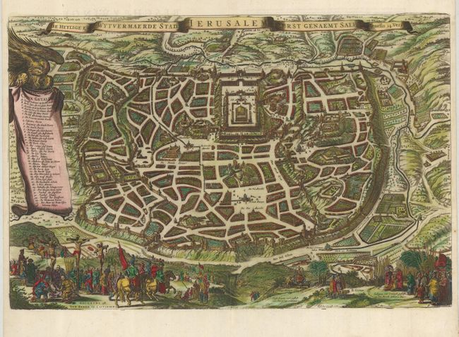
MapMaker: |
Nicolas Visscher
|
|
| |
| |
Subject: |
Holy Land, Jerusalem |
|
| |
Period/Size: |
1657 / 12.5" x 19.0" (31.8 x 48.3 cm)
|
|
| |
Color: |
Colored
|
|
| |
Condition: |
(+B) Lovely impression and color with a couple of short tears in the bottom margin, well away from the map. Professional reinforcement of centerfold on verso and invisibly repaired tear in map at lower center. (condition help) |
|
| |
Source: |
|
|
| |
References: |
Laor #1155; Poortman & Augusteijn #121. |
|
| |
|
|
| Sales Information |
| |
| |
Price: |
|
|
| |
| |
Offered by: |
Old World Auctions |
|
| |
Catalog: |
Auction No. 121 - Antique Maps, Charts, Atlases & Globes (614) |
|
| |
Lot/Item #: |
716 |
|
| |
| |
Date: |
09/2007
|
|
| |
| |
|