Title:
“Johnson's New Illustrated (Steel Plate) Family Atlas with Physical Geography, and with descriptions, Geographical, Statistical, and Historical…”
Map Maker:
Johnson & Ward
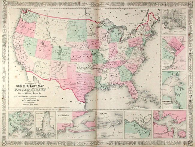
This large folio atlas includes the beautifully en... (full text available to subscribers)
| Item Detail |
| |
| |
MapMaker: |
Johnson & Ward
|
|
| |
| |
Subject: |
Atlases |
|
| |
Period/Size: |
1864 / 18.5" x 15.5" (47.0 x 39.4 cm)
|
|
| |
Color: |
Colored
|
|
| |
Condition: |
(B) Contents generally good to very good with occasional scattered foxing or soiling, some centerfold splits, and other flaws commonly seen in these atlases. The flags plate has a long tear, Iowa & Nebraska sheet is detached, and the southwest plate is a (condition help) |
|
| |
Source: |
|
|
| |
References: |
|
|
| |
|
|
| Sales Information |
| |
| |
Price: |
|
|
| |
| |
Offered by: |
Old World Auctions |
|
| |
Catalog: |
Auction No. 120 - Antique Maps, Charts, Atlases & Globes (613) |
|
| |
Lot/Item #: |
852 |
|
| |
| |
Date: |
07/2007
|
|
| |
| |
|
Antique Maps - Valuation and Pricing, Descriptions, Resources |
|
Home |
Information |
Search |
Register |
Contact Us |
Site Map
Americana Exchange, Inc. © 1999 - 2024 Americana Exchange, Inc.. All rights reserved.
OldMaps.com, the OldMaps.com logo and
AMPR are service marks or registered service marks of Americana Exchange, Inc..
|