Title:
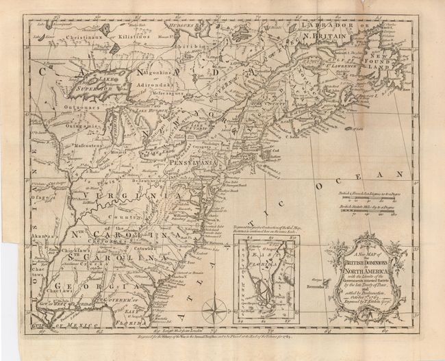
“A New Map of the British Dominions in North America; with the Limits of the Governments annexed thereto by the late Treaty of Peace, and settled by Proclamation, October 7th, 1763”
Map Maker:
Thomas Kitchin
A very historical map illustrating the British col... (full text available to subscribers)
| Item Detail |
| |
| |
MapMaker: |
Thomas Kitchin
|
|
| |
| |
Subject: |
Colonial United States and Canada |
|
| |
Period/Size: |
1763 / 9.4" x 11.8" (23.9 x 30.0 cm)
|
|
| |
Color: |
Black & White
|
|
| |
Condition: |
(+B) A dark impression on a folded sheet with a small hole near the west end of Lake Superior. One small marginal fold separation at the top with some toning on folds. There is the usual binding trim at left with enough margin left for framing. (condition help) |
|
| |
Source: |
Annual Register |
|
| |
References: |
McCorkle 763.5; Sellers & Van Ee 103; Jolly ANNREG-3. |
|
| |
|
|
| Sales Information |
| |
| |
Price: |
|
|
| |
| |
Offered by: |
Old World Auctions |
|
| |
Catalog: |
Auction No. 121 - Antique Maps, Charts, Atlases & Globes (614) |
|
| |
Lot/Item #: |
124 |
|
| |
| |
Date: |
09/2007
|
|
| |
| |
|
Antique Maps - Valuation and Pricing, Descriptions, Resources |
|
Home |
Information |
Search |
Register |
Contact Us |
Site Map
Americana Exchange, Inc. © 1999 - 2024 Americana Exchange, Inc.. All rights reserved.
OldMaps.com, the OldMaps.com logo and
AMPR are service marks or registered service marks of Americana Exchange, Inc..
|