| Item Detail |
| |
| |
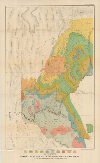
MapMaker: |
U.S. Geological Survey
|
|
| |
| |
Subject: |
United States - Southwestern |
|
| |
Period/Size: |
1881 / 29.0" x 18.0" (73.7 x 45.8 cm)
|
|
| |
Color: |
Colored
|
|
| |
Condition: |
(A) Brilliant color, strong impression and full margins. One panel darkened on verso only, a couple tiny fold intersection splits, else fine. (condition help) |
|
| |
Source: |
Annual Report 1881 |
|
| |
References: |
|
|
| |
|
|
| Sales Information |
| |
| |
Price: |
|
|
| |
| |
Offered by: |
Old World Auctions |
|
| |
Catalog: |
Auction No. 121 - Antique Maps, Charts, Atlases & Globes (614) |
|
| |
Lot/Item #: |
214 |
|
| |
| |
Date: |
09/2007
|
|
| |
| |
|