Title:
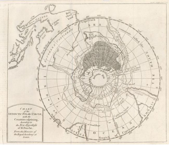
“Chart of the Antarctic Polar Circle, with the Countries Adjoining, According to the New Hypothesis of M. Buache”
Map Maker:
Philip Buache
A circular polar projection including part of sout... (full text available to subscribers)
| Item Detail |
| |
| |
MapMaker: |
Philip Buache
|
|
| |
| |
Subject: |
South Pole |
|
| |
Period/Size: |
1763 / 7.6" x 8.7" (19.3 x 22.1 cm)
|
|
| |
Color: |
Black & White
|
|
| |
Condition: |
(A) A nice example with a very light backing of Japanese tissue to reinforce some small, marginal tears. (condition help) |
|
| |
Source: |
Gentleman's Magazine |
|
| |
References: |
Jolly GENT-166. |
|
| |
|
|
| Sales Information |
| |
| |
Price: |
|
|
| |
| |
Offered by: |
Old World Auctions |
|
| |
Catalog: |
Auction No. 121 - Antique Maps, Charts, Atlases & Globes (614) |
|
| |
Lot/Item #: |
046 |
|
| |
| |
Date: |
09/2007
|
|
| |
| |
|
Antique Maps - Valuation and Pricing, Descriptions, Resources |
|
Home |
Information |
Search |
Register |
Contact Us |
Site Map
Americana Exchange, Inc. © 1999 - 2024 Americana Exchange, Inc.. All rights reserved.
OldMaps.com, the OldMaps.com logo and
AMPR are service marks or registered service marks of Americana Exchange, Inc..
|