Rister or Sign In to see pricing information


Title:

A New Generall Chart for the West Indies of E. Wright's Projection…

Map Maker:

Seller & Price

A New Generall Chart for the West Indies of E. Wright's Projection…

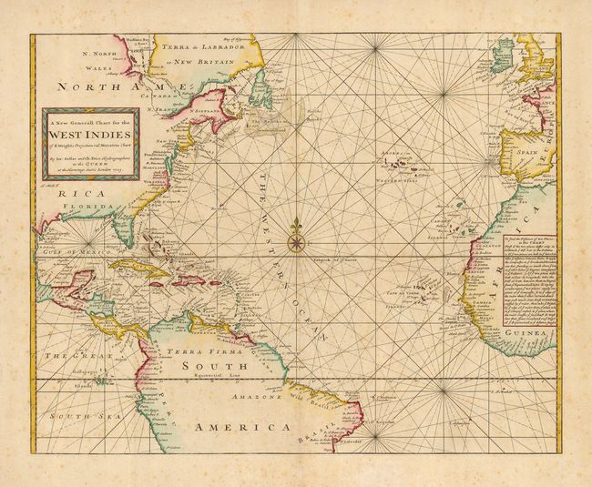
This striking and rare sea chart covers most of th... (full text available to subscribers)
Item Detail
 
  MapMaker:  

Seller & Price


  Subject:  Atlantic Ocean  
  Period/Size:  1703 / 17.8" x 22.5"  (45.3 x 57.2 cm)  
  Color:  Colored  
  Condition:  (B) Printed on a sound sheet with original color and some overall foxing. There are a couple of short, marginal tears, well away from the map. (condition help)  
  Source:   
  References:   
 
 
Sales Information
 
  Price: 

Please register your email to view records, or sign in with email address to see records


  Offered by:  Old World Auctions  
  Catalog:  Auction No. 121 - Antique Maps, Charts, Atlases & Globes (614)  
  Lot/Item #:  409  
 
  Date:  09/2007  


Antique Maps - Valuation and Pricing, Descriptions, Resources


Home | Information | Search | Register | Contact Us | Site Map

Americana Exchange, Inc. © 1999 - 2024 Americana Exchange, Inc.. All rights reserved. OldMaps.com, the OldMaps.com logo and
AMPR are service marks or registered service marks of Americana Exchange, Inc..