Title:
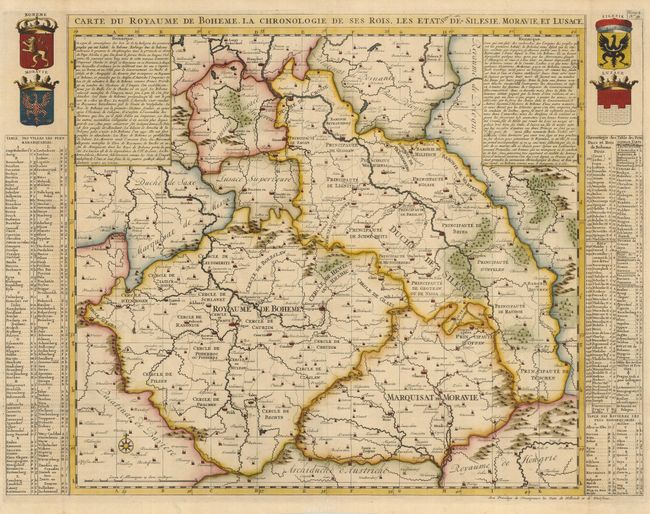
“Carte du Royaume de Boheme, La Chronologie de ses Rois, Les Etats de Silesie, Moraviae, et Lusace”
Map Maker:
Henry Abraham Chatelain
This is a very attractive and informative map of t... (full text available to subscribers)
| Item Detail |
| |
| |
MapMaker: |
Henry Abraham Chatelain
|
|
| |
| |
Subject: |
Czech Republic |
|
| |
Period/Size: |
1708 / 18.5" x 24.5" (47.0 x 62.3 cm)
|
|
| |
Color: |
Colored
|
|
| |
Condition: |
(A) A nice impression with attractive color. The folds have been reinforced on the verso with tissue. (condition help) |
|
| |
Source: |
Atlas Historique… |
|
| |
References: |
Phillips (A) #548, Vol.2 No. 39. |
|
| |
|
|
| Sales Information |
| |
| |
Price: |
|
|
| |
| |
Offered by: |
Old World Auctions |
|
| |
Catalog: |
Auction No. 121 - Antique Maps, Charts, Atlases & Globes (614) |
|
| |
Lot/Item #: |
615 |
|
| |
| |
Date: |
09/2007
|
|
| |
| |
|
Antique Maps - Valuation and Pricing, Descriptions, Resources |
|
Home |
Information |
Search |
Register |
Contact Us |
Site Map
Americana Exchange, Inc. © 1999 - 2024 Americana Exchange, Inc.. All rights reserved.
OldMaps.com, the OldMaps.com logo and
AMPR are service marks or registered service marks of Americana Exchange, Inc..
|