Title:
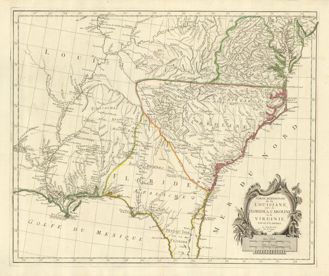
“Partie Meridionale de la Louisiane, avec la Floride, la Caroline et la Virginie”
Map Maker:
Anville/Santini
This is a fascinating Italian version of D'Anville... (full text available to subscribers)
| Item Detail |
| |
| |
MapMaker: |
Anville/Santini
|
|
| |
| |
Subject: |
Colonial Southeast |
|
| |
Period/Size: |
1776 / 19.0" x 22.5" (48.3 x 57.2 cm)
|
|
| |
Color: |
Colored
|
|
| |
Condition: |
(A) Clean bright impression on a sturdy sheet with original outline color. The upper margin has a few tiny wormholes, stopping just shy of the map. There is one tiny rust spot off the coast of New Orleans. (condition help) |
|
| |
Source: |
Atlas Universel |
|
| |
References: |
Phillips (A) #647-48; Sellers and Van Ee #1408. |
|
| |
|
|
| Sales Information |
| |
| |
Price: |
|
|
| |
| |
Offered by: |
Old World Auctions |
|
| |
Catalog: |
Auction No. 121 - Antique Maps, Charts, Atlases & Globes (614) |
|
| |
Lot/Item #: |
189 |
|
| |
| |
Date: |
09/2007
|
|
| |
| |
|
Antique Maps - Valuation and Pricing, Descriptions, Resources |
|
Home |
Information |
Search |
Register |
Contact Us |
Site Map
Americana Exchange, Inc. © 1999 - 2024 Americana Exchange, Inc.. All rights reserved.
OldMaps.com, the OldMaps.com logo and
AMPR are service marks or registered service marks of Americana Exchange, Inc..
|