| Item Detail |
| |
| |
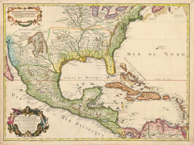
MapMaker: |
Guillaume Delisle
|
|
| |
| |
Subject: |
Colonial North America and Caribbean |
|
| |
Period/Size: |
1703 / 18.8" x 25.3" (47.8 x 64.3 cm)
|
|
| |
Color: |
Colored
|
|
| |
Condition: |
(+B) A dark impression with later color on a sheet with margins that have been trimmed a little, but are still sufficient for framing. The left and lower margins and an extraneous fold have old paper reinforcements on verso. (condition help) |
|
| |
Source: |
|
|
| |
References: |
Tooley (AMER) #48, pp. 22; Cumming #137; Wheat pp 58-61; Wagner #474; Schwartz & Ehrenberg pl. 82 |
|
| |
|
|
| Sales Information |
| |
| |
Price: |
|
|
| |
| |
Offered by: |
Old World Auctions |
|
| |
Catalog: |
Auction No. 121 - Antique Maps, Charts, Atlases & Globes (614) |
|
| |
Lot/Item #: |
100 |
|
| |
| |
Date: |
09/2007
|
|
| |
| |
|