Title:
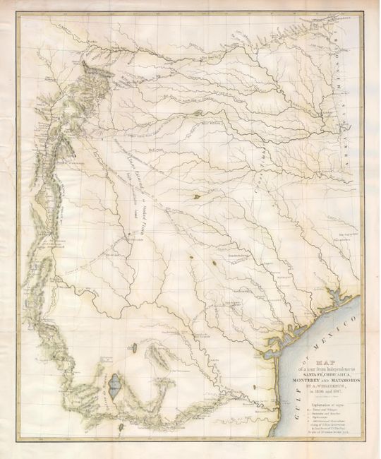
“Map of a Tour from Independence to Santa Fe, Chihuahua, Monterey and Matamoros”
Map Maker:
Frederick Adolphus Wislizenus
This is a fascinating map of the early state of T... (full text available to subscribers)
| Item Detail |
| |
| |
MapMaker: |
Frederick Adolphus Wislizenus
|
|
| |
| |
Subject: |
United States & Mexico, Texas |
|
| |
Period/Size: |
1848 / 20.0" x 16.3" (50.8 x 41.4 cm)
|
|
| |
Color: |
Colored
|
|
| |
Condition: |
(B) A nice clear impression on a sheet that has been backed with Japanese tissue. The binding trim on the left has been extended to accommodate framing and the 2" binding tear has been repaired. There are a few faint damp stains in the map. (condition help) |
|
| |
Source: |
A Memoir of a Tour to Northern Mexico… |
|
| |
References: |
Wheat (TMW) #573. |
|
| |
|
|
| Sales Information |
| |
| |
Price: |
|
|
| |
| |
Offered by: |
Old World Auctions |
|
| |
Catalog: |
Auction No. 121 - Antique Maps, Charts, Atlases & Globes (614) |
|
| |
Lot/Item #: |
326 |
|
| |
| |
Date: |
09/2007
|
|
| |
| |
|
Antique Maps - Valuation and Pricing, Descriptions, Resources |
|
Home |
Information |
Search |
Register |
Contact Us |
Site Map
Americana Exchange, Inc. © 1999 - 2024 Americana Exchange, Inc.. All rights reserved.
OldMaps.com, the OldMaps.com logo and
AMPR are service marks or registered service marks of Americana Exchange, Inc..
|