| Item Detail |
| |
| |
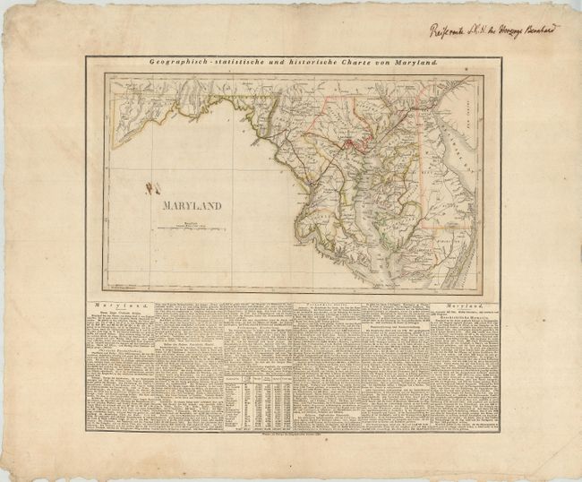
MapMaker: |
Weimar Geographisches Institut
|
|
| |
| |
Subject: |
Maryland and Delaware |
|
| |
Period/Size: |
1826 / 11.2" x 19.2" (28.5 x 48.8 cm)
|
|
| |
Color: |
Colored
|
|
| |
Condition: |
(B) There is an ink stain on the blank area of the map. There is a small tear to the right of Washington, D. C, and one more in the right portion of the map at top. Very wide original margins with some chipping and creasing at the edges and a couple smal (condition help) |
|
| |
Source: |
American Atlas |
|
| |
References: |
|
|
| |
|
|
| Sales Information |
| |
| |
Price: |
|
|
| |
| |
Offered by: |
Old World Auctions |
|
| |
Catalog: |
Auction No. 121 - Antique Maps, Charts, Atlases & Globes (614) |
|
| |
Lot/Item #: |
177 |
|
| |
| |
Date: |
09/2007
|
|
| |
| |
|