Title:
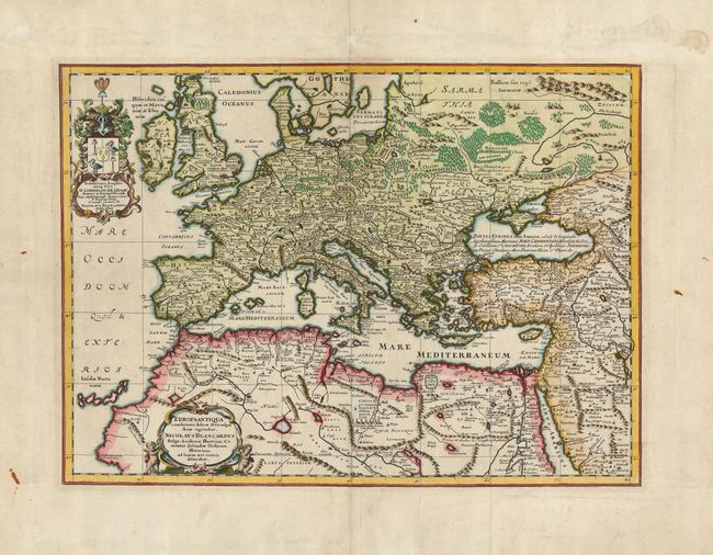
“Europa Antiqua cum finitimis Africae & utriusque Asiae regionibus Nicolaus Blancardus Belga, Leidensis, Illustrium Comitatus Zelandiae Ordinum Historicus, ad lucem aevi veteris delineabat.”
Map Maker:
Jan Jansson
An uncommon map of Europe, extending to the Middle... (full text available to subscribers)
| Item Detail |
| |
| |
MapMaker: |
Jan Jansson
|
|
| |
| |
Subject: |
Europe |
|
| |
Period/Size: |
1650 / 14.5" x 20.0" (36.9 x 50.8 cm)
|
|
| |
Color: |
Colored
|
|
| |
Condition: |
(A) Superb impression on a sheet with professional repairs and a couple stains, all in the margins and not affecting the map. A couple of printer's creases in the map. The centerfold has been reinforced on the verso. (condition help) |
|
| |
Source: |
Atlas Novus |
|
| |
References: |
|
|
| |
|
|
| Sales Information |
| |
| |
Price: |
|
|
| |
| |
Offered by: |
Old World Auctions |
|
| |
Catalog: |
Auction No. 121 - Antique Maps, Charts, Atlases & Globes (614) |
|
| |
Lot/Item #: |
425 |
|
| |
| |
Date: |
09/2007
|
|
| |
| |
|
Antique Maps - Valuation and Pricing, Descriptions, Resources |
|
Home |
Information |
Search |
Register |
Contact Us |
Site Map
Americana Exchange, Inc. © 1999 - 2024 Americana Exchange, Inc.. All rights reserved.
OldMaps.com, the OldMaps.com logo and
AMPR are service marks or registered service marks of Americana Exchange, Inc..
|