Title:
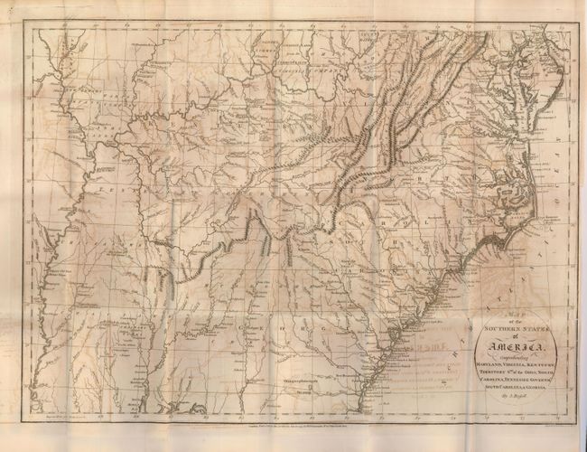
“Map of the Southern States of America, Comprehending Maryland, Virginia, Kentucky, Territory Sth. of the Ohio, North Carolina, Tennessee Governmt., South Carolina, & Georgia”
Map Maker:
John Russell
Very interesting map of the early, post-colonial s... (full text available to subscribers)
| Item Detail |
| |
| |
MapMaker: |
John Russell
|
|
| |
| |
Subject: |
Southeast United States |
|
| |
Period/Size: |
1795 / 14.5" x 20.0" (36.9 x 50.8 cm)
|
|
| |
Color: |
Black & White
|
|
| |
Condition: |
(B) A sturdy sheet with folds as issued. The map has some offsetting, and a few intersectional fold splits, repaired on the verso with archival tape. The binding trim leaves 1/8" margins for framing and a binding tear into the border has been repaired w (condition help) |
|
| |
Source: |
Historical, Geographical ...View of the United States |
|
| |
References: |
|
|
| |
|
|
| Sales Information |
| |
| |
Price: |
|
|
| |
| |
Offered by: |
Old World Auctions |
|
| |
Catalog: |
Auction No. 122 - Antique Maps, Charts, Atlases & Globes (615) |
|
| |
Lot/Item #: |
220 |
|
| |
| |
Date: |
12/2007
|
|
| |
| |
|
Antique Maps - Valuation and Pricing, Descriptions, Resources |
|
Home |
Information |
Search |
Register |
Contact Us |
Site Map
Americana Exchange, Inc. © 1999 - 2024 Americana Exchange, Inc.. All rights reserved.
OldMaps.com, the OldMaps.com logo and
AMPR are service marks or registered service marks of Americana Exchange, Inc..
|