|
|
||
Title:
“A Plan of the Country from Frogs Point to Croton River Shewing the Positions of the American and British Armies from the 12th of October 1776 untill the Engagement on the White Plains on the 28th”
Map Maker:
Samuel Lewis
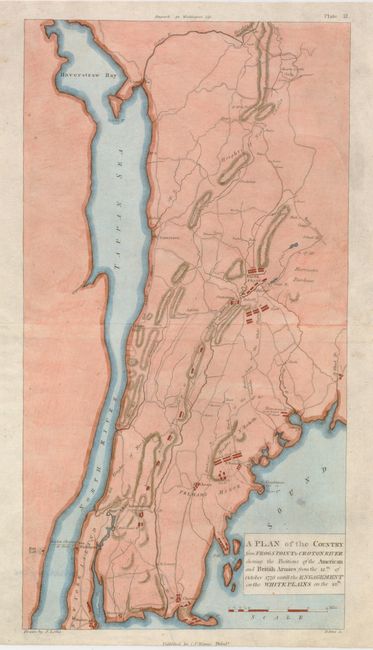
A handsome Revolutionary War plan that cent... (full text available to subscribers)
|
|
|||||||||||||||||||||||||||||||||||||||||||||||||||||||||||||||||||||||||||||||||||||||||
Antique Maps - Valuation and Pricing, Descriptions, Resources | ||||||||||||||||||||||||||||||||||||||||||||||||||||||||||||||||||||||||||||||||||||||||||
|
Home |
Information |
Search |
Register |
Contact Us |
Site Map
Americana Exchange, Inc. © 1999 - 2024 Americana Exchange, Inc.. All rights reserved.
OldMaps.com, the OldMaps.com logo and |