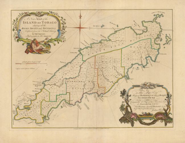
Title:
“A New Map of the Island of Tobago shewing all the Rocks Shoals and Soundings Engraved from an Actual Survey”
Map Maker:
Thomas Kitchin
An extremely rare map of Tobago, later copied by W... (full text available to subscribers)
| Item Detail |
| |
| |
MapMaker: |
Thomas Kitchin
|
|
| |
| |
Subject: |
Tobago |
|
| |
Period/Size: |
1762 / 17.2" x 23.4" (43.7 x 59.5 cm)
|
|
| |
Color: |
Colored
|
|
| |
Condition: |
(A) Excellent impression and color on a strong sheet with minor soil and chipping in the generous margins. Centerfold reinforced on verso. (condition help) |
|
| |
Source: |
|
|
| |
References: |
MCC-10, #35. |
|
| |
|
|
| Sales Information |
| |
| |
Price: |
|
|
| |
| |
Offered by: |
Old World Auctions |
|
| |
Catalog: |
Auction No. 122 - Antique Maps, Charts, Atlases & Globes (615) |
|
| |
Lot/Item #: |
399 |
|
| |
| |
Date: |
12/2007
|
|
| |
| |
|
Antique Maps - Valuation and Pricing, Descriptions, Resources |
|
Home |
Information |
Search |
Register |
Contact Us |
Site Map
Americana Exchange, Inc. © 1999 - 2024 Americana Exchange, Inc.. All rights reserved.
OldMaps.com, the OldMaps.com logo and
AMPR are service marks or registered service marks of Americana Exchange, Inc..
|